Lawrence Halprin: Jim Ellis Freeway Park, 1970D–1976
- Seattle, Washington, USA, Show on map
- #REC #North America
-
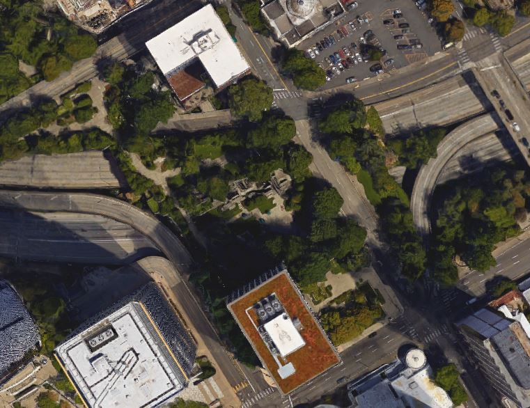
After a long, controversial planning period, the Jim Ellis Freeway Park was built in 1976 amidst and on top of a large multi-level “knot” of roads. Landscape architect Lawrence Halprin and his office had been chosen 1970 to design a solution that closes an “open wound” in the central area of the city. The construction was finished in 1976.
Seattle represents typical modern urban architecture. The city center is characterized by a square grid that lies next to the water. Many high-rise houses mark the area and everything is constructed in a regular system. The city’s wound was caused by the construction of a twelve-lane freeway that cuts through this uniformity. It is a large multi-level traffic node that divided parts of the town. To create a transition in this intersected area which measures 5.2 acre, a park concept arose that should fit to the look of Seattle’s city architecture, but also should offer a recreation and meeting space for the inhabitants in a designed and greened environment.Â
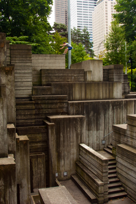
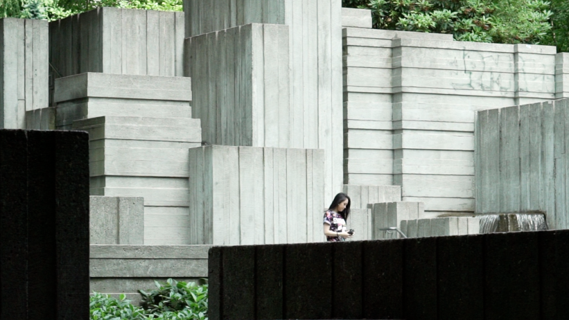
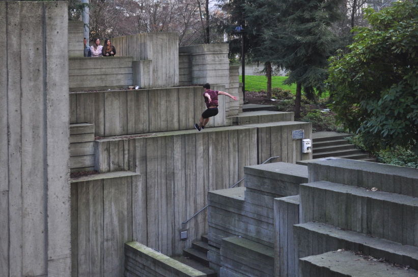
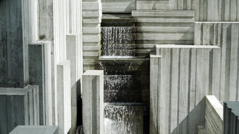
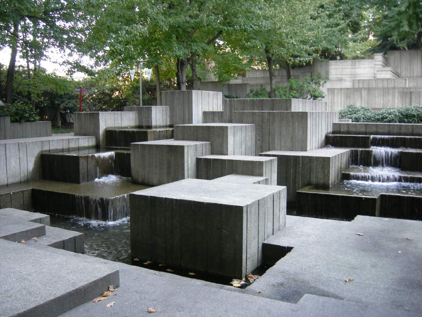
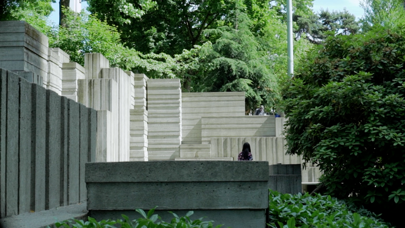
Through meadows and planted trees run paths out of irregular composed square exposed concrete panels. They lead to the Brutalist highlight of the park: canyons that are built out of different sized concrete cubes. Along some of these cubes, waterfalls run down into basins, others invite to climb on it or jump from one to the other. The cube configuration provides an artificial mountain mass to hike on in the middle of the city, surrounded by a forested section.Â
-
Heritage protected. Since the end of 2019, the Freeway Park is listed on the National Register of Historic Places and on the Washington Heritage Register. In May 2022, it also gained official landmark status from the City of Seattle.